
If you like hiking in Hong Kong, there is a place that you must make a visit – Tai Mo Shan.
I’ve been to Tai Mo Shan a number of times. Cold Winter, cool autumn, hot summer; Sunny day, rainy day; hiking and even cycling. No matter how and when, you will find your ways to enjoy.

Why so special?
Tai Mo Shan is the highest peak in Hong Kong with an elevation of 957 metres. When viewed from distant, it looks like a big hat and so got its Chinese name “大帽山“. Surrounding it is the Tai Mo Shan Country Park that spanned across an area of about 14 Square Kilometers.
Given these special nature, it is expected that your will have excellent 360º view of Hong Kong from the top and a good place for hiking around the Country Park.
Where is it?
Tai Mo Shan is located in the Central New Territories of Hong Kong with Kam Tin / Pat Heung at its north and Tsuen Wan at it south. To its east is Lam Tsuen / Taipo and to its west is Tuen Mun.
How to get there?
Public transportation
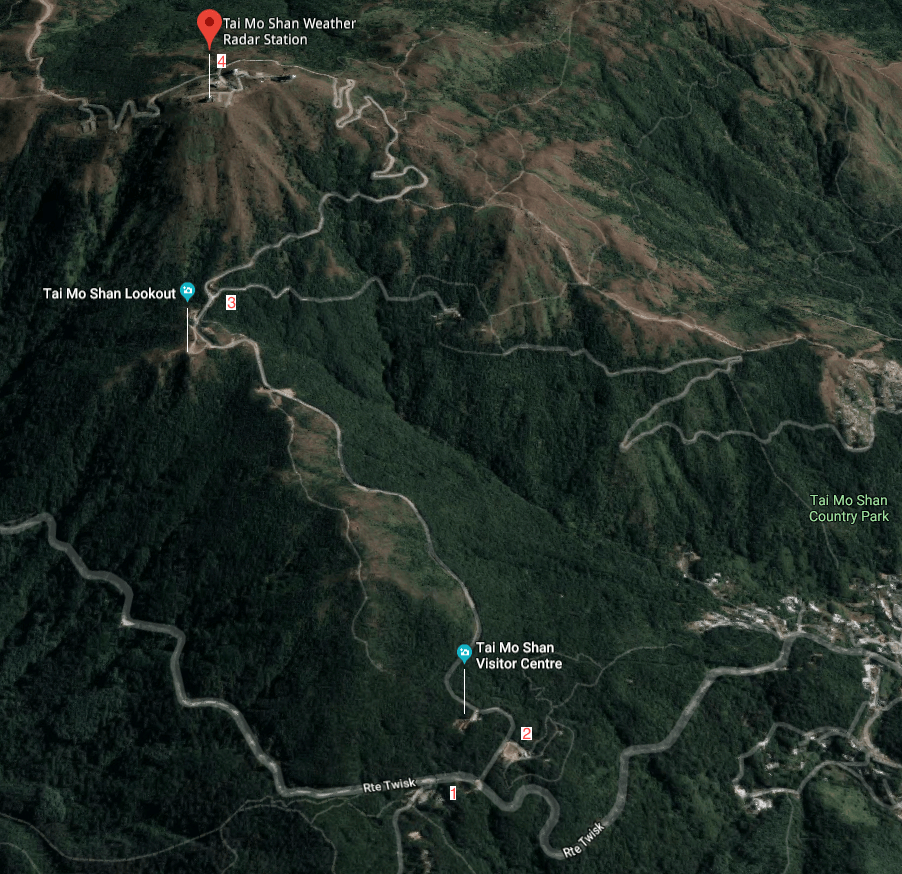
You can take the KMB (Kowloon Motor Bus) Route 51 from the bus terminal at Tsuen Wan West Station. This is a circular route and be sure to get off at the bus stop near Route Twisk Country Park Management Centre. (Mark #1 in the above map)
Alternatively, you can also take a taxi to the Tai Mo Shan Rotary Club Park.
Driving
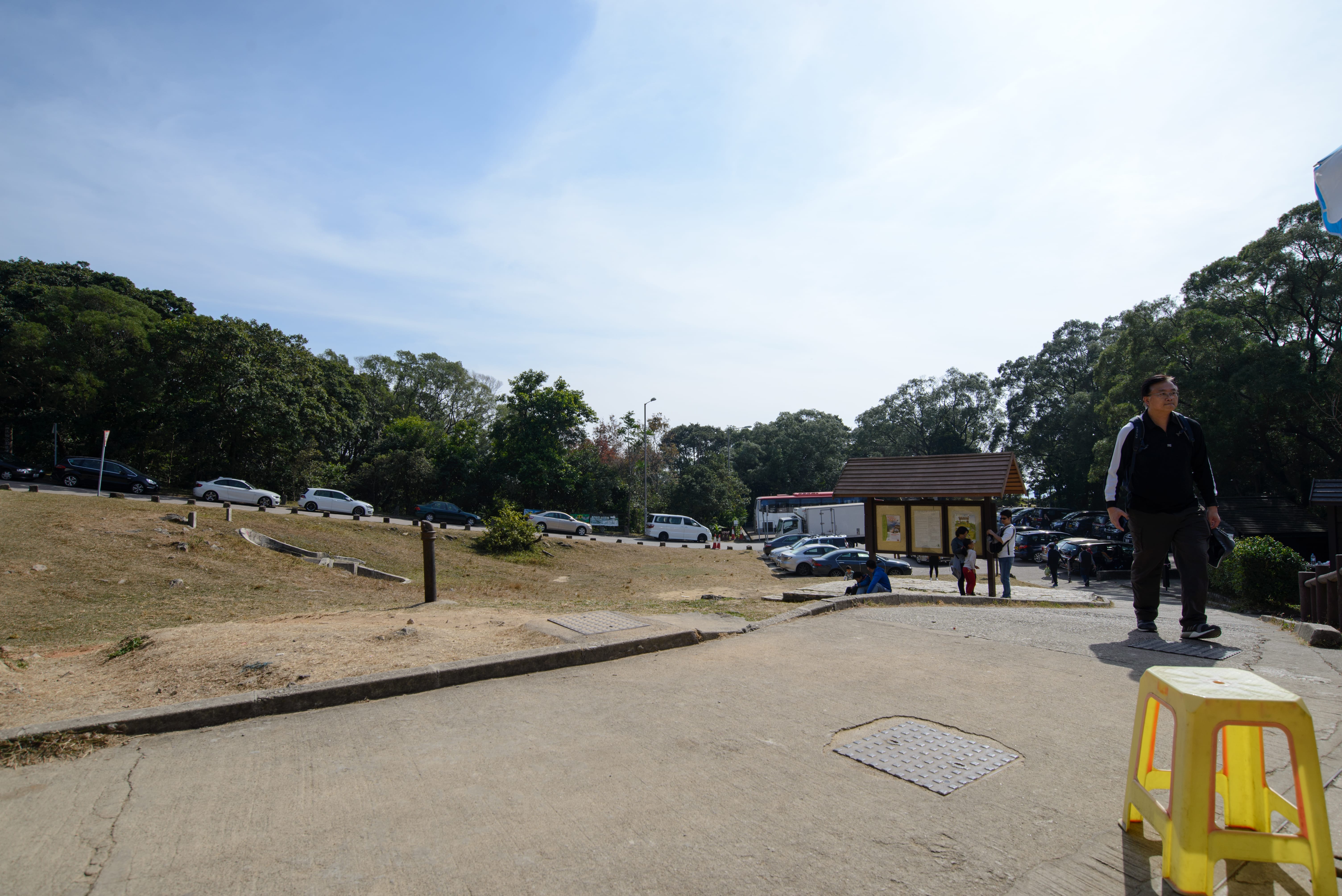
If you got a car, you may drive up the Route Twisk to the public car park in the Rotary Club Park (Mark #2 in the above map) or the Visitor Centre, from either Tsuen Wan or Kam Tin. However, the parking lots are very small and may get full most of the time.
For my visit last Saturday, I arrived at Tai Mo Shan before 10:00 in the morning and could only get a parking space next to the Visitor Centre.
Cycling
Finally, if you are a cyclist, you can ride along the Route Twisk just like normal drivers. Or you can make use of the Tai Lam Country Park just like what I had done before. Starting from Tai Tong Shan Road in Yuen Long, Tai Lam Nature Trail, MacLehose Trail Section 10 & 9 to the Rotary Club Park.
The following information should provide some ideas on these routes:
- Route Twisk from Tsuen Wan: 6.3 Km with average gradient of 7%
- Route Twisk from Kam Tin: 4.7 Km with average gradient of 8%
- Tai Tong Shan Road via MacLehose Trails: 13.6 Km with average gradient of 5%
Climbing along Route Twisk is much shorter but quite dangerous as there are a lot of cars and motorcycles racing along next to you.
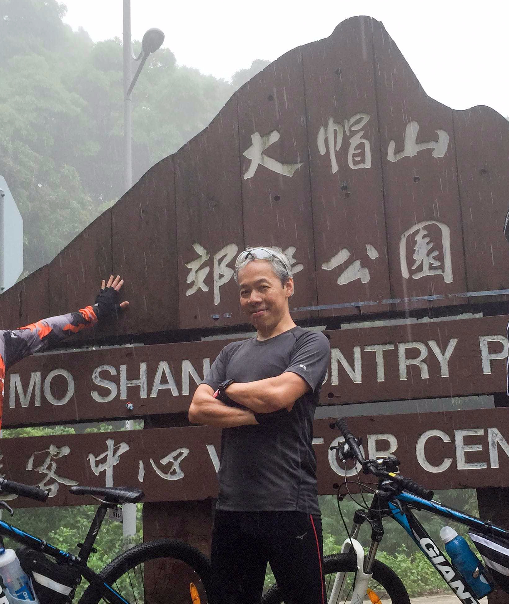
By the way, this is how I went up to Tai Mo Shan with my friends via Tai Tong Shan Road few years ago.
What can you do in Tai Mo Shan?
Most people come here for its beautiful natural scenery while some are for taking challenges. There are also serious photographers staying overnight just to capture the special moments they are looking for.

Hiking
The most common hiking route is to start from the Rotary Club Park and with the Tai Mo Shan Weather Radar Station (Mark #4 in the above map) as the destination. This route is approximately 4.5 Kilometres long with an average gradient of 10%, properly paved and normally requires 2 hours of hiking time.
Since there is NO support facilities along the Tai Mo Shan Road, make sure you get enough water and snacks at the Tai Mo Shan Kiosk. Also, don’t forget to visit the toilet before you set off.
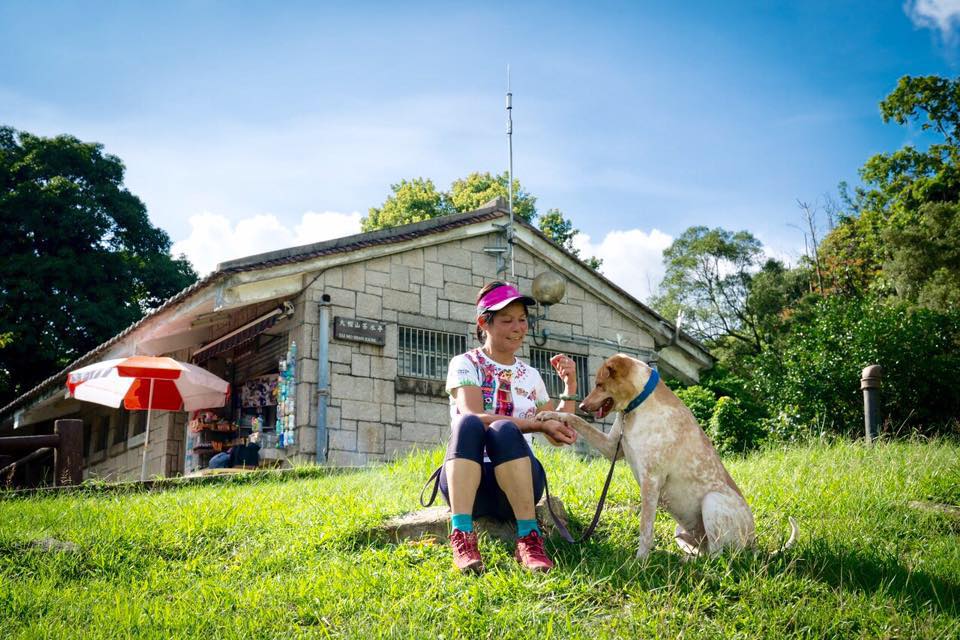
In the picture above is Lin Ger, owner of the Kiosk and the “Unofficial Spokeswoman of Tai Mo Shan“. She has run the Kiosk for over 10 years and is familiar with everything in Tai Mo Shan. In case you have encountered any issues, consult Lin Ger for any assistance or advice.
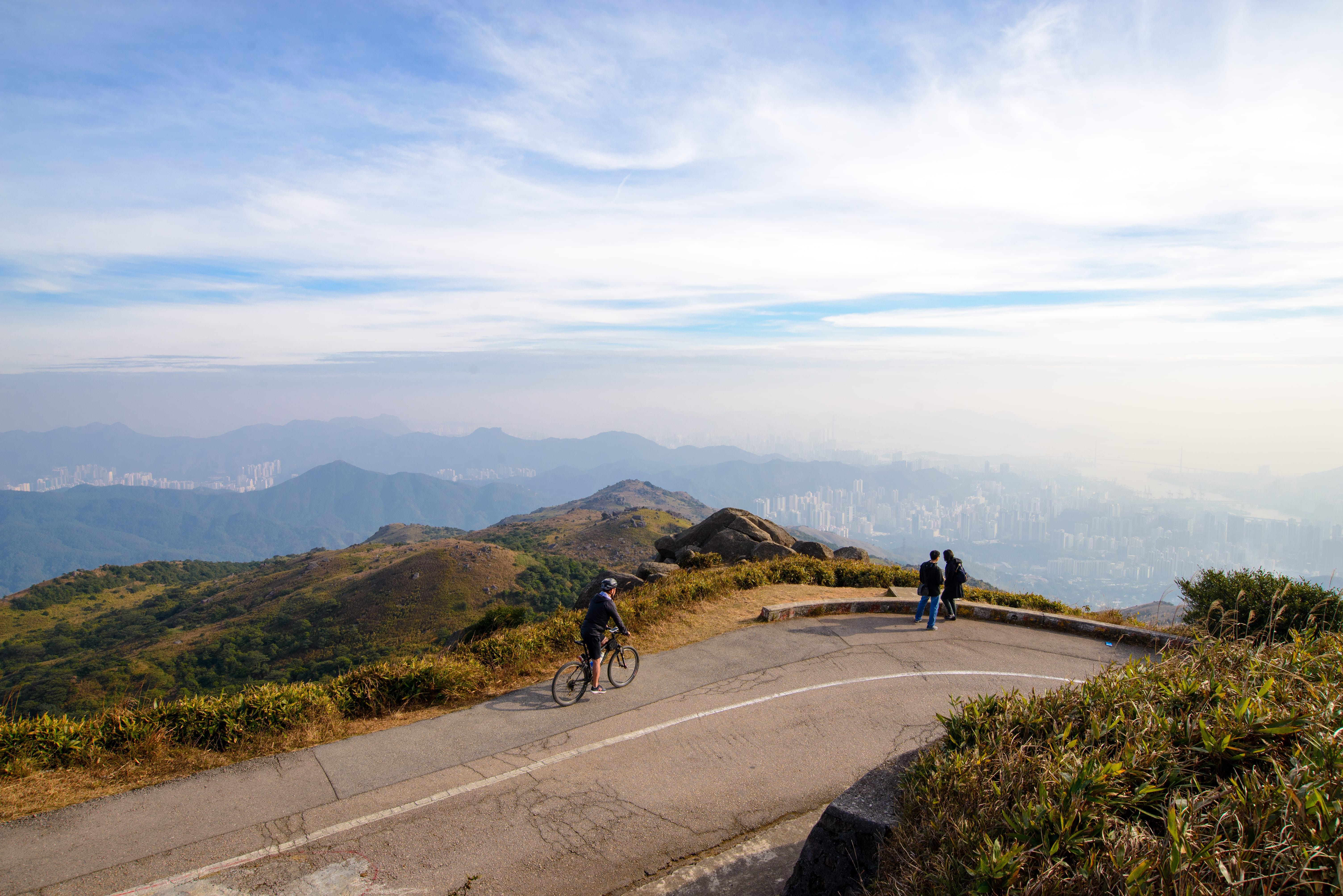
Tai Mo Shan Lookout (Mark #3 in the above map).


Near the Tai Mo Shan Lookout is the upper Tai Mo Shan Car park.
A manned control gate is erected next to the car park. Vehicles are not allowed to enter beyond that point unless with permission.
Bicycles are permitted but is limited only to the paved road.
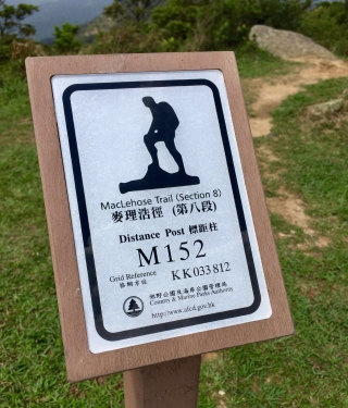
Right after the control gate, you will come to Distance Post M152, an excellent view-point of the northern and western sides of Tai Mo Shan.
Take a look at the panorama I have taken last week.
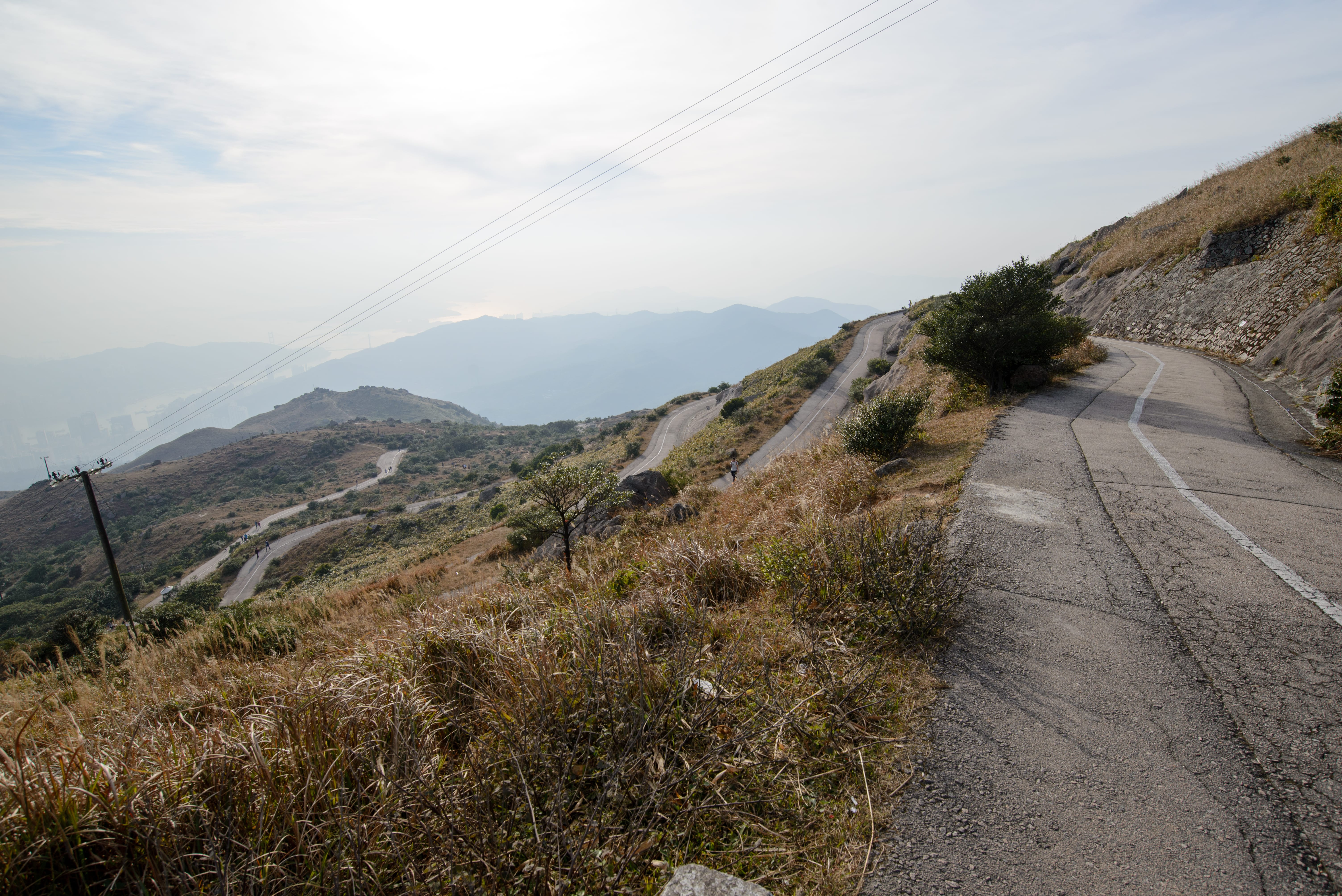
Personally, I think the remaining portion of Tai Mo Shan Road is relatively easier for hiking.
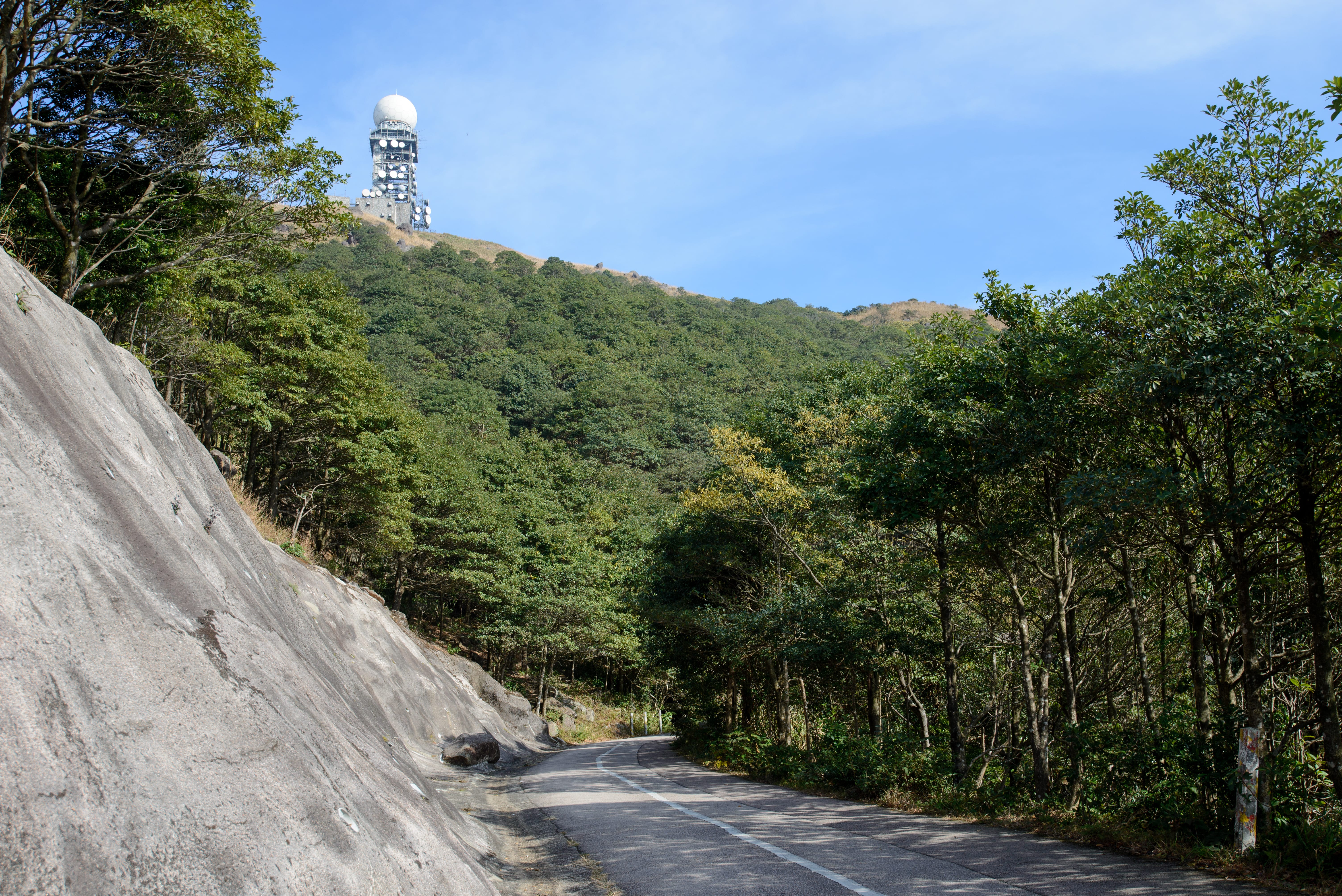
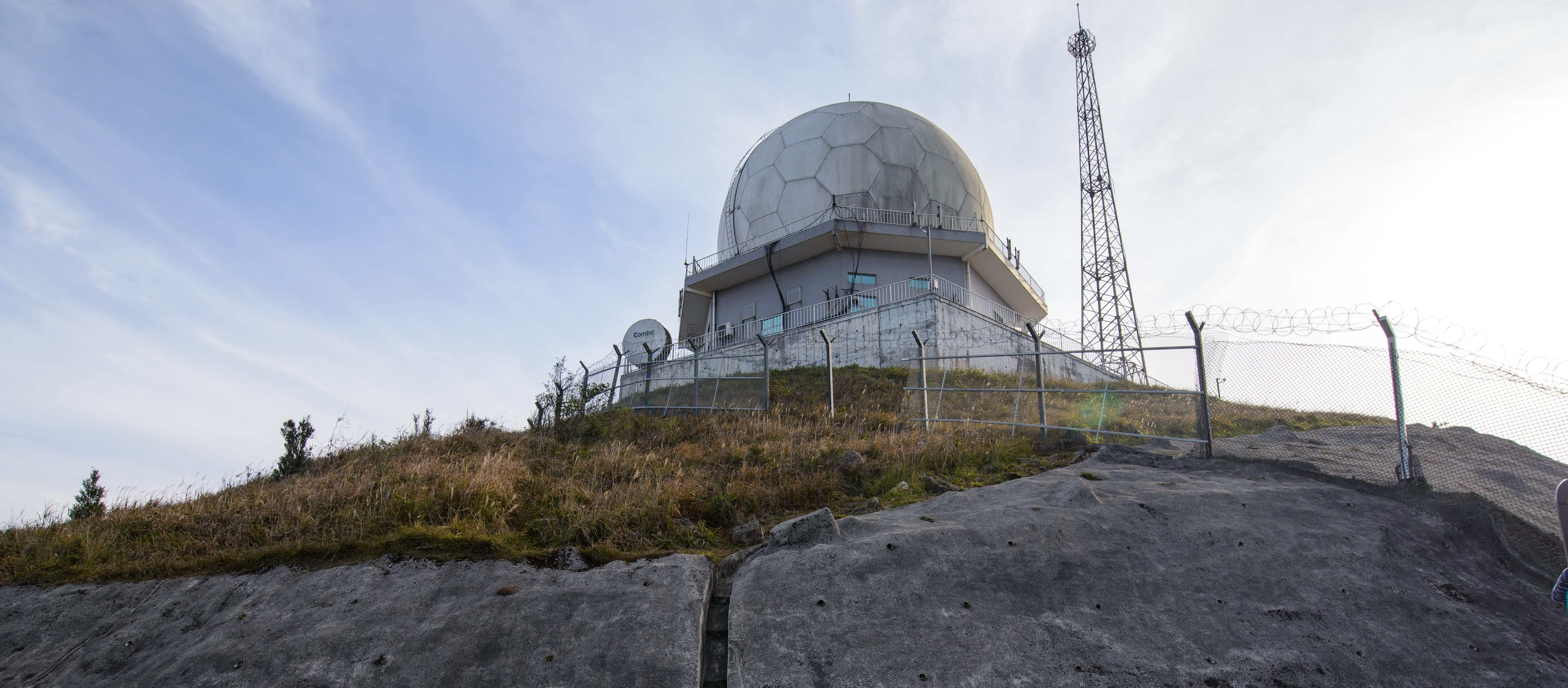
Finally, arrived at our destination, the Tai Mo Shan Weather Radar Station.

Cycling
Climbing to the top of Hong Kong is one of the achievements that cyclists are eager for. Some come here for challenging themselves while others are taking advantage of the steep slopes and the series of hairpin bends for their regular climbing exercise.
My best attempt was to ride to the control gate right next to the upper car park, few years ago.


May be I should get more climbing exercise and have the top of Tai Mo Shan as my next target!
Photography / Videography
Being the highest peak and located in the centre of the New Territories, you can view almost every part of Hong Kong from the top of Tai Mo Shan. No matter you are a seasoned photographer or beginner; no matter what the weather condition will be, you will definitely get stunning photographs here.
Tai Mo Shan in the afternoon


Tai Mo Shan at Sunset
If you would like to explore more about Hong Kong from Tai Mo Shan, take a look at the following video as taken by one of the famous Hong Kong photographers, Mr. Will Cho. (Courtesy of Will Cho)
Who should or should not go with you?
Of course, any good hiking buddy can go with you.
However, hiking in Tai Mo Shan is not a trivial task, take note of the following when you plan your trip:
Distance
- The trip from Rotary Club Park to the top is about 4.5 Kilometres in length with an average gradient of 10%. This is definitely NOT for beginners.
Weather
- There is NO shelter along the path from Rotary Club Park to the top. Make sure you and your buddies can stand the intense sunlight as well as heavy rain.
- In winter, the lowest temperature in Hong Kong (-6º C) were recorded here in Tai Mo Shan. Furthermore, road surface may be covered by frost and become extremely slippery.
Moreover, I don’t suggest to bring infants, babies as well as elderly here.
What should be brought with you?
Basically water, drinks, snacks and some foods as there is NO support facilities along the hiking journey. The only place you can get water and snack is the Tai Mo Shan Kiosk at the Rotary Club Park at the entrance of Tai Mo Shan Road.
Other things come to mind are:
- Sun care products with sufficient UV protection
- Sunglasses
- Jacket and/or clothing that relevant to the weather condition
- Umbrella, rain-coat in case of rain
- Torch if you may stay late in Tai Mo Shan
- Your mobile phone
- Camera
Another name of Tai Mo Shan in Chinese is “大霧山” meaning that the place is very foggy all year around. Take a look at the following lapse video I have taken last week to get some idea of the ever-changing weather conditions. Cloudy at the beginning and sunny again within minutes.
Last but not least, remember to bring your power-bank as well.
What can you do afterward?
If you start early in the morning, probably you can finish the hiking slightly after noon. You may consider to go down the Route Twisk to Pat Heung or the Kam Tin old town for a late rustic lunch.
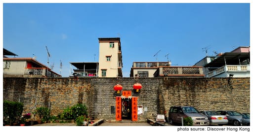
If you are not in a hurry, I would suggest to take a short visit to Kat Hing Wai Walled Village as well. A historical heritage that was built about 500 years ago.
Before planning your next trip to Tai Mo Shan, take a look at the 3D summary of hiking from the Rotary Club Park to the top of Tai Mo Shan.
Categories: Cycling, Hiking, Hong Kong, Photography, Riding in Hong Kong, Travel

My faher loves to yum cha here haha
LikeLiked by 1 person
Choi Lung Restaurant at Chuen Lung Village. Right? People say that Choi Lung’s tea is fresh and the dim sums are tasty.
LikeLiked by 1 person
I think so! To be honest i never went with him..he goes up at 6am 😓😓😓
LikeLiked by 1 person
As a Newbie, I am continuously searching online for articles that can be of assistance to me. Thank you
LikeLike
哇,一點進來看你的網頁就看見大帽山,一定要講幾句了。
三年前一月回港玩渣馬,也開車上過大帽山,那天好大風,吹到頭都甩,風景真的好靚,可以望晒元朗大平原,也拍了點短片,不過放了在臉書,等我睇睇點樣放番上個人網站。那天早上行程好緊密,上完大帽山去屏山,跟住上埋飛鵝嶺,我都大個人都係第一次上飛鵝嶺。跟住冇時間,否則會去埋大嶼山。XDDD
LikeLiked by 1 person
行去咁多地方又真係好趕喎。我其實好想喺大帽山睇日出,不過又怕黑,仲驚有蛇 😱😱
LikeLike
我哋開車嘅,如果唔係點上飛鵝山啊。我都驚蛇。紐約同東岸有度好,係冇毒蛇架﹗﹗蛇仔就有,不過我都驚。上次在郊外露營搭營時就搭正喺條蛇度,嚇到條蛇走咗,我朋友話:「而家安全晒,肯定呢個位完全冇蛇。」真係想暈……
LikeLiked by 1 person
Thank you for the nice write-up.
Is it possible to park in the upper public car park? Is it possible to get a parking space there early in the morning?
LikeLiked by 1 person
Yes, there are two public car parks closed to the entrance and one more just right in front of the gate. As the car parks are free and with limited parking space available, be sure to arrive early 👌
LikeLike